WaterTribe Ultimate Florida Challenge 2016
First Hand Account Of Doooobrd's Challenge
By Don Polakovics (Doooobrd)
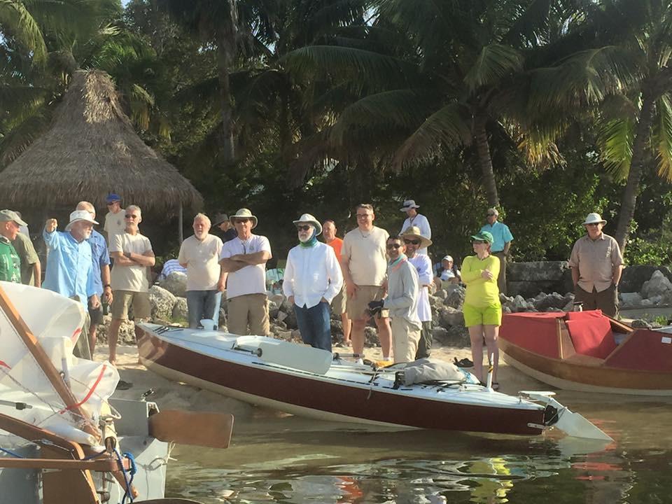
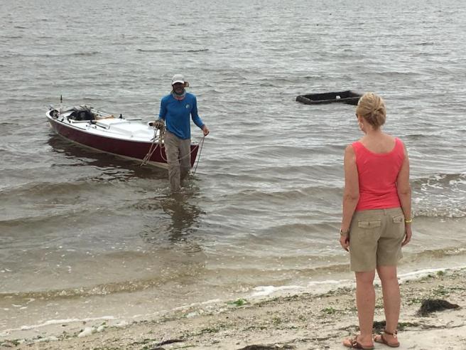
Seeing the Patuxent Queen (PQ), Dave wandered over to my Fort DeSoto campsite soon after I arrived. A retired
WWII veteran he and his wife Ramona visited the park in their pickup camper, as their health allowed. We made
small talk for an hour or so and I didn’t think much more of our meeting. In the predawn morning of race day,
the two of them, with some difficulty I imagined, walked the line of nearly a hundred boats on the beach to find
PQ and see us off. I was deeply touched. It was not where I was expecting my thoughts to be at the beginning of
a 1200 mile race around Florida.
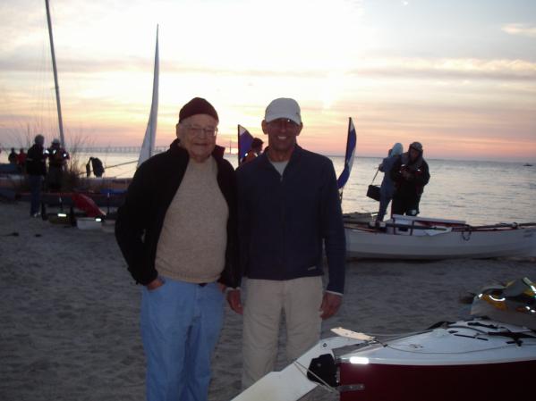
Dave and I minutes before the start
An unofficial count put 87 boats on the beach doing the Everglades Challenge, a ~270 mile race to Key Largo and
11 boats doing the 1,200 mile Ultimate Florida Challenge (UFC). When it was over 33 and 6 boats respectively
completed their challenges. The race started with a wonderful light northeast breeze that made the ~60 mile run
to Cape Haze, the first checkpoint, relatively easy. The large number of boats there made for a festive
atmosphere. I stopped long enough to check in, pick up some water and exchange gossip about other competitors
(the afternoon wind was strong enough to cause some boat failures) before heading out to take advantage of the
still favorable breeze. That night I anchored off the Intracoastal Waterway (ICW) just short of Charlotte
Harbor. The wind was getting a little boisterous and I didn’t want to do the crossing in the dark. The next
morning the wind veered a little to the south, but the tight reach across Charlotte Harbor was doable, if a bit
wet and bumpy. Favorable breezes of various strengths continued until sunset, taking me all the way to Gordon
Pass, where I left the Gulf of Mexico for sheltered water. I anchored in, for want of a better description, a
canal cul-de-sac surrounded by million dollar homes. It was perfectly legal, but strange listening to people’s
veranda conversations.
By the next morning the wind (true to forecast) veered to the southeast, though it wasn’t strong enough to be a
factor until entering the Gulf of Mexico below Cape Romano. I had lunch and short conversation with BeaV (Bob
Vollhaber) while anchored at Tripod Key before slogging up wind to Indian Key Pass (entrance to Chokoloskee
Bay). Darkness fell in the pass as the wind died completely. As I approached Everglades City, mosquitoes became
a real nuisance for the first time in the trip.
The second checkpoint at Chokoloskee was swamp in every sense of the word; mildew smell, bugs, humidity and
yards of deep, boot sucking black mud between water and land. The Challenge was becoming more… well …
challenging. And the mood at CP2 was decidedly more somber. Some competitors were killing time waiting for
transportation and shore support folks were nervously waiting for withdrawing competitors to arrive. The
forecast was filled entirely with headwinds and small craft advisories. I filled some water bags,
chatted with the very helpful CP volunteers and retired to my (now muddy) boat for the night.
Arriving at Checkpoint 2, Chokoloskee Island (with the much loved mud in the foreground)
The next day started later than I had intended and it only got worse when 30 minutes out I concluded that two
days of water may not be enough to reach Flamingo. As there were no other options for water, I returned to
Choko’, waded through the mud once again and took on an extra gallon.
The remainder of the day was a mind (and butt) numbing bottom slam into steep 3 foot waves and a 20 knot
headwind. I turned off the GPS, not needing the reminder that well spaced wave trains consistently reduced the
2.2 knot cruise to 0.8 knots and any break from pedaling was rewarded with a 1.4 knot drift north. The pre-race
plan to reach Whitewater Bay that evening was clearly not going to happen. Instead, I elected to put the
miserable day to an end and anchored behind Wood Key. The Key blocked most of the waves, but was too low to stop
the wind, at least making bug netting unnecessary. As an added bonus, if the wind died during the night, the
mosquitoes would wake me to take advantage of the lull.
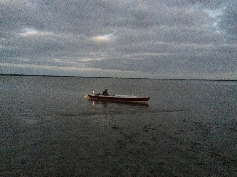
At 0230, I woke up to buzzing in my ears and quickly packed up and got underway. The progress made during every
hour of this lull, would be worth two when the wind cranked up. Mercifully the wind held off until after sunrise
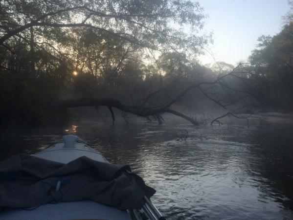
when I was within Ponce de Leon Bay. By the time I reached the Joe River the wind was gusting to 30 knots and
remainder of the day was consumed crawling to the Buttonwood Canal. Buttonwood is this narrow, creepy, overgrown
channel; full of strange sounds and things bumping your hull in the dark. It also provided complete protection
from the wind and unfettered access by mosquitoes. What better way to celebrate the last couple miles to the
third check point, Flamingo.
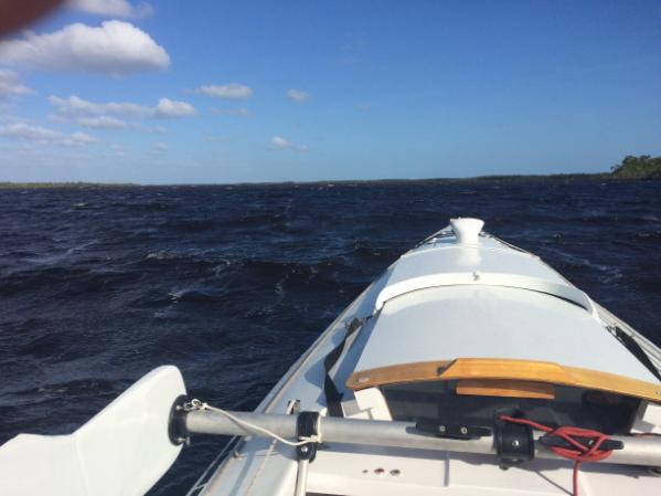
Upwind on the Everglade’s Joe River
Rather than deal with portaging the boat around the lock that separates the fresh water Everglades from salt
water Florida Bay, I checked in with the CP captain, (tribal name Greybeard…he and Ridgerunner finished within
seconds of me in the 2005 Everglades Challenge) and returned to the boat to sleep. The forecast was for 30 knots
out of the south, but figured I’d get up early, do the portage and then decide based on actual conditions.
The forecast was accurate. Even walking required a decided lean into the wind. Looks like I was to be a tourist
for a day…as much as it was killing me. It did, however, provide a good opportunity to take a wonderful solar
shower at the campground and have a couple of sit down, non-noodle meals. Throughout the day boats struggled
into Flamingo, as we mulled over the proverbial “should I stay or should I go”. One Kruger paddler (JoeWildlife)
made a go of it around midday, but was back in time for an early supper, remarking that conditions weren’t
dangerous, you just couldn’t get anywhere. Tourists, oblivious to the wind that was so important to us, were
taking great delight in videoing each other chasing seagulls sheltering on the docks. For once I was cheering
for the gulls. I decided to try the 0300 departure tactic again.
I slipped out of Flamingo right on schedule and commenced the tedious spotlighting of informal marks defining
narrow Florida Bay channels with whimsical names like Twisty Mile and Tin Can. Miraculously PQ never touched
bottom, despite the best efforts of cormorants to sit on poles and mimic the direction arrows of homemade
markers. The forecast exaggerated the day’s wind and I clocked into Key Largo around 1700. The crossing was a
comparatively pleasant pedal against a 10-15 knot breeze over brilliant turquoise water.
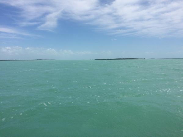
Florida Bay (beats a day at the office)
At the terminus of the Everglades Challenge, there was a definite party atmosphere. The beach was crowded with
happy ‘tribers and small boats of all sorts. Seconds after landing a beer was thrust into my hand, which I
reluctantly declined. I was going to need to get out of there quickly. BeaV kindly gave me a ride to the Publix
grocery store to provision for the next leg of the UFC. By ~1900 I was underway with the day’s headwind now
pushing me along. It felt good to sail again. The plan was to get to an anchorage far enough north to allow a
daylight crossing of Biscayne Bay the next morning. That night I anchored in Tarpon Basin at the edge of a field
of a dozen or so cruising sailboats. These guys typically don’t move in the dark, so I wasn’t too concerned
about being run over.
First Stage Finish at Key Largo Immediately to my right in the white shirt is Greybeard
(Michael Collins), next to him Chief (Steve Isaac) founder and benevolent overlord of Watertribe and to his
right is Graham Byrnes owner of B&B Yacht Designs of Core Sound sailboat fame…prototype Core Sound 17 mk3 at
left corner. Ridgerunner (Doug Cameron) is point out something for us.
Every snap of a buckle and clank of equipment seemed to echo across the anchorage as I slipped back to the ICW
in pre-dawn darkness. The waterway was well marked and easily followed by spotting marks with a light. Soon
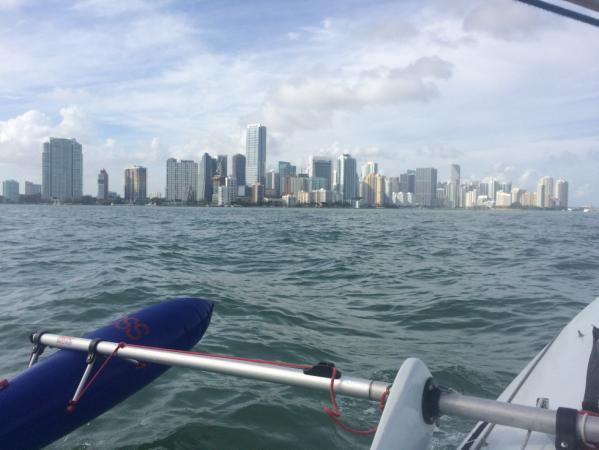
after entering the open expanse of Biscayne Bay, the sun came up to a clear sky. Buoyed by a perfect forecast, I
elected to sail a straight line 26 nm crossing. The morning was spent catching up on some boat tidying, email,
phoning Mom & Sis and of course eating. The skyline of Miami was visible for most of the day and with its
approach came increasing concentrations of pleasure boats (it was Saturday) and the commensurate chop.
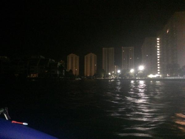
By early afternoon I entered the “concrete canyon”, a 60+ mile urban stretch of the ICW going through Miami,
Fort Lauderdale and other cities. Although it was not great for sailing, it provided the sanctuary of extended
“no wake” zones. The other benefit was the frequent spoil islands. I anchored behind one just after sunset,
rather than deal with drunken pleasure boaters in the dark.
Miami, gateway to the “Concrete Canyon”
Still befuddled by the one hour time change (it doesn’t take much) I got underway a bit after 0200 and had a
pleasant urban pedal-sail in a light variable breeze. The sun arose to reveal dozens of huge cruise ships docked
in Port Everglades. It struck me as ironic that most of the ships sported huge “jumbotron” screens on their
superstructures. Cruising is so much fun you need to watch television on deck?
O’dark Thirty in Fort Lauderdale
The lines of condos and hotels never ended while bridges marked progress along the ICW. Even at 15 feet, I had
to take my mast down to clear five of them. By mid afternoon, pleasure boaters were out in force. This was a
particularly non-nautical breed, devoid of any consideration for other boaters. Bridges in particular were a
free for all. Large boats would be struggling to maintain position while waiting a bridge opening, while smaller
boats would dart around them. Florida law specifies no wake at bridges, so smaller boats from both directions
would race up to the bridge and then come off plane sending steep waves into the bridge channel from both
directions. This, with the stiff current (most bridges had causeways that funneled the water to the center
bridge span) made bridges an adventure. That day a policeman ordered me to remove my sail, because it was
illegal on the ICW. Really? That night I anchored in a quiet cove next to the golf course in Lake Worth.
The high rises gradually faded and the days on the Indian River and up the Space Coast fell into a bit of a
routine: ~ 0300 departure, travel until dark, repeat. This allowed 16 hours of travel time and daylight to find
a place to anchor. One occurrence that comes to mind in this stretch was cruising into a fog bank at about four
in the morning. It was a total and complete blackout; no horizon, no stars, no navigation marks. I continued
that way for over an hour, completely dependent on the GPS waypoint needle. The second event was also early
morning, while transiting the turning basin in the Port of Palm Beach. I noted the pilot boat and presumed he
saw my navigation lights. What I had completely missed was the container ship he was next to. My initial scans
didn’t look high enough to see the ship’s bow towering over me. Yup, that woke me up.
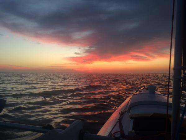
Storms approaching over the Ponce de Leon Inlet Lighthouse
(I usually deploy the amas to ride out a
storm on the boat…slept through this one)
After Saint Augustine avoiding strong tidal currents (3.5+ knots in some places) became the dominate
consideration and sleep was grabbed whenever I was waiting for the tide. The first overnighter of the trip was
taken to ride favorable current up to the Saint John River, where a couple of hours of sleep were grabbed
waiting for the river’s ebb to ease before crossing. I saw the distinctive silhouette of Jarhead’s (Bill Fite)
Sea Pearl around midnight, but it wasn’t until the St. John River crossing the next afternoon that we had a
chance to talk. Jarhead was doing a “full coast” version of the UFC, starting at the Alabama-Florida line to
cover the entire Gulf Coast. Bill sailed (he could make that boat move in the lightest breeze) and I “motor
sailed” and pedaled to the stage checkpoint at Fort Clinch State Park, arriving a little after 2100. Actually it
was at the boat ramp next to the park. For some reason the park prohibits boat landings (including kayaks) on
its premises.
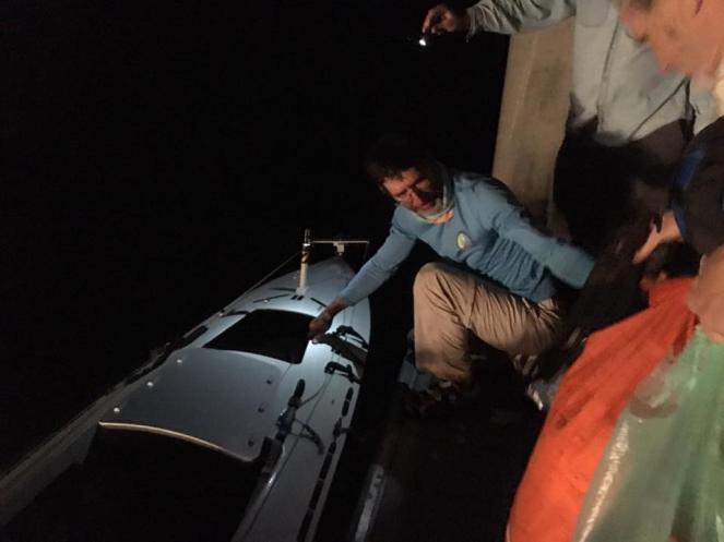
Chief, Sandy Bottom (Dawn Stewart), Greybeard (Michael Collins) and Ridgerunner (Doug Cameron) were there to
greet us. Dawn dropped out earlier at Fort Pierce due to a shoulder injury and was doing checkpoint duty, while
waiting for her son Allan (SOS) to finish the race. He finished in 18 days…setting a new single handed record.
This was, I believe, her third UFC, so she had nothing to prove. In any case she solved my immediate need for
food resupply (I only carried gorp and dehydrated suppers for the entire trip) by generously giving me her snack
food for that stage of the challenge. Every day after that was a bit like Christmas. “Let’s see what Sandy
Bottom packed for us today.”
Both Jarhead and I moved offshore to anchor for the remainder of the night. The next morning I anchored off of
the beach at Fort Clinch State Park and waded ashore to get a shower and charge my phone. Upon returning I was
shocked to find my boat on the beach with a park ranger, Greybeard and danceswithwaves (Royd Whedon) in
attendance. The park ranger mistook a line loosely tied to a piece of
driftwood as the primary means to restrain the boat (the line was there to pull the boat closer to shore, since
an offshore breeze was swinging it to the far side of the anchor). To keep my boat from drifting away, he
dragged the boat (including anchor) ashore and contacted Watertribe to recover my boat. Sigh. Although the tide
wasn’t scheduled to change for another four hours, I loaded up and headed for the Saint Mary’s River.
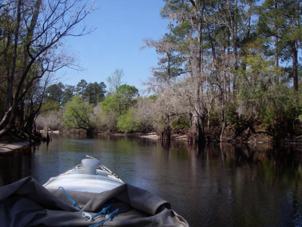
The lower St Mary’s is a (very) meandering grass lined river. As predicted, the tidal current kept me to a two
knot pace up to the idyllic little town of St. Mary’s. Slack tide was still a couple of hours away, so I tied up
at the courtesy floating dock and had a nice eggplant parmesan meal in town(yes, I took the outdoor seating) and
a leisurely cup of coffee at the kayak rental/bike rental/hotdog stand near the municipal dock. Around 1500 the
current finally started to turn and I cast off for the overnight 43 nm pedal up to Trader’s Hill, which marks
the upper limit of the tidal St. Mary’s River. It turned out to be a crisp, clear night with a bright ¾ full
moon. Navigation was easy. It was one of those “it’s great to be alive” nights. The flooding tide more than made
up for the light headwind and Trader’s was reached 0500. By this time I was quite chilled and quickly prepared
the cabin to warm up under covers and catch a few Z’s.
Soon after daybreak I was rudely awakened by someone pounding on my deck. When I popped my head out of the
cabin, the fisherman apologized and said that he thought the boat might have been abandoned. In your dreams bud.
I tied up at the nearby boat ramp and walked up to the somewhat dilapidated campground to use the bathrooms.
They were locked. It was time to move on.
The upper St. Mary’s river is a narrow convoluted affair with thickly wooded, steep banks. Some ‘tribers
referred to it as the “Deliverance Section” of the river. That prejudice aside, it was quite pretty. Wild turkey
and deer were in abundance and beautiful white sand spits were just starting to make their appearance. About
halfway through the 30 miles to the takeout at St. George, PQ had her first hard grounding. The submerged log
did a number on the Mirage Drive fins. I knew this would happen eventually, but had hoped to get further
upstream before having to paddle. As the day wore on, the current became stronger and the obstructions more
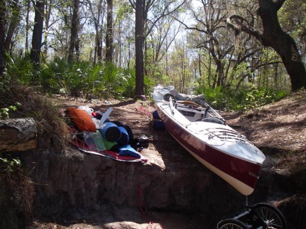
frequent. At dusk, I gave up; cold, hungry, tired and frustrated. I anchored next to a small sand spit to get
access to the front compartment and retrieve parts necessary to switch to the shorter Mirage fins and fix the
day’s damage. While supper “cooked” in its foil pouch insulated by my sleeping bag, I finished the Mirage
repairs and organized the boat for the next day’s travels (snack food, water, maps, battery changes etc.). The
decision of which direction I would be traveling was left open. Upstream to attempt to continue or downstream to
return to Fort Clinch and pull out. Relieved to complete the evening’s chores, I climbed into the sleeping
compartment and sat on supper, disgorging the pouch of meat lasagna into my sleeping bag. Screw it. I held the
sleeping bag in my lap, ate the lasagna, rinsed that section of the sleeping bag in the river…and had a
wonderful night’s sleep.
The St. Mary’s River; “Snag City”
The morning began with naive optimism as I commenced paddling the last 7-10 miles of the St. Mary’s. The river
continued to narrow and the strainers became more frequent. Some took multiple tries to get past. One series of
blow-downs required an S turn to navigate and I got pinned on a strainer. By rolling the boat downstream I was
able to get the bow and stern out of the water (one advantage of a beamy boat) and pivot off of the tree. On the
second attempt, rather than attempt the S turn, I rammed the branches hoping they would be brittle enough to
break before killing my momentum. In a shower to twigs, bark and little spiders PQ made it through. I was never
so happy to see the road bridge that marked the boat ramp at Saint George.
A father and his young son were just launching their sit-on-tops to ride the river down to Trader’s Hill. I
warned them of the strainers, whereupon the father asked me what a strainer was. I explained and further
cautioned them to be careful. Guess they survived, though I wished I had been more strident in my warning.
Chief was waiting at the boat ramp. He cheerfully noted that I was not expected to make it through the St.
Mary’s River. I was wondering myself, I admitted. With his help we got the boat unloaded and floated on to the
MOAB-C (mother of all boat-carts) and I started the 40 mile portage to Fargo, Georgia.
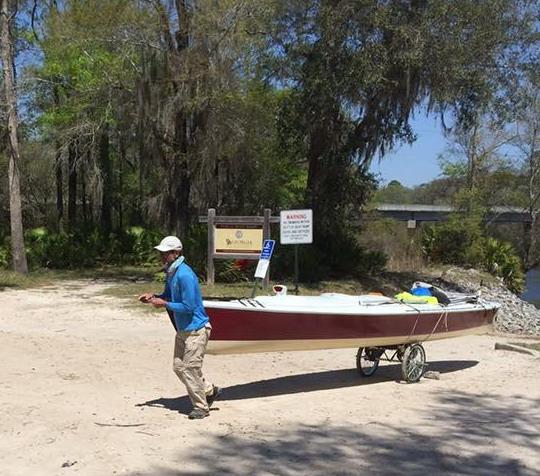
Goodbye St. Mary’s River. Hello Route 94.
Despite her heft (250-300 lbs), PQ rolled easily on 20 inch pneumatic wheels. She was trimmed such that a light
down load on the portage yoke (paddle) was required, supporting the weight of my arm. For my part, it felt
wonderful just to stand up. After a quick stop for groceries in St. George the portage began in earnest.
Unlike in 2006, people did not stop to ask if I needed a ride. I guess they’re getting used to portagers walking
through every four years or so. One couple did stop to ask about my “journey” and invite me to a pow-wow that
evening at the nearby Cherokee Reservation. About an hour before sunset, two dear friends made the drive down
from Savannah to visit. It was a special treat seeing friendly faces on that empty stretch of road. Race rules
prohibited them from giving me anything (like supper!), but the gift of encouragement was much greater.
Traffic was light and the logging trucks gave me lots of space on the narrow tar and chip Georgia
part of the route. The Florida section was by contrast smooth macadam with wide bicycle lanes on either side.
After dark the traffic thinned even further. Vehicles were visible as silent dots of light on the horizon long
before racing by in a crescendo of light, noise and wind; after which the road returned to stillness with only
the chirping of insects and occasional call of a Barred owl…oh yeah…and the rumble of a freight train. Around
2300, I lay down on the warm pavement to stretch and admire the stars. It was like being alone in the world.
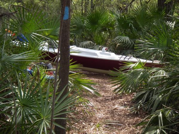
After a couple of more hours of walking, I pulled off on a dirt forest road, camouflaged the boat with a tarp,
and took a couple hour nap in my bivy bag. There was no point in getting to Fargo before sunrise.
Like most stages, the last mile seemed to take forever, but I did make it to the Suwannee River Visitor Center
in Fargo. After a filling breakfast of Beanie Weenies and Frito Corn Chips, I slowly emptied the boat, floated
her in the Suwannee, repacked and got underway on this strange and exotic river. Alligators were out in
abundance sunning on the bank. One launched himself off the beach and surfaced right in front of me. My bow hit
him with a solid thunk. Fortunately he dove and didn’t hit the drive unit (probably more fortunate he didn’t
take a bite out of the boat). The occasional riffles and strainers discouraged night travel, so I made a short
day of it. I was tired from the portage and could use the sleep anyway.
Suwannee River Just Below Fargo, Georgia
The following day the pedal down to Big Shoals, the only Class III rapids on the Suwannee, resumed. Surprisingly
only a STOP sign with no explanation warned of the rapids ahead. The takeout was a relatively steep bank with a
chest high vertical step that required 3:1 tackle and a fair amount of rope work to navigate. Just as I got the
boat loaded on the cart on level ground a canoeist (Ben) showed up. I was envious as he tossed out his two
portage bags, hoisted the carbon North Star (I believe) canoe on his shoulders and headed down the trail. Later
as we were shuttling gear we got to talking. His wife had recently passed away and this was his first solo trip.
His wife’s name was Gay, thus inevitably as a paddling team they were known as BenGay. She obviously still
dominated his thoughts.
Hoisting the Queen up the Big Shoals Takeout
The Big Shoals Portage is like walking through a beautiful tropic garden. Seeing Colonel Sanders on a white
horse with a huge black-brown hound dog only added to the exoticness. A couple of hundred yards into the portage
trail I rounded a bend to see a bearded man in shorts, no shoes, riding a white (maybe light gray) horse
bareback with his giant hound “Swamp Yeller”. Both he and the dog were quite friendly, though they did make me a
little nervous as they followed along through the whole portage. I had gear piled up at three separate locations
along the trail and was concerned (probably unreasonably) about recovering all of it. Ben had taken a shorter
portage route (it crossed a ditch I couldn’t navigate) and wasn’t aware of this encounter until Swamp Yeller
found him. All is well that ends well. Col. Sanders excused himself. Ben got under way. And I reversed the
winching process to return PQ to her element and resume our journey. The portage took about six hours.
A Tropical Garden
Big Shoals was followed by Little Shoals and four more sets of riffles that required pulling in the drive unit
and raising the rudder, but were kind of fun to navigate. Unfortunately I didn’t get terribly far in the flat
water before hitting a submerged object with the Mirage drive, followed by hearing an ominous rumble of thunder.
Guess this was going to be another short day. I passed a large pavilion on the right, but only after reaching
the Stephen Foster State Park Launch did I recognize it as part of the park. Ben was already camped at the canoe
launch, having found that the “official” campground was too far a walk. He also mentioned that the water was
turned off. I tied up at the launch and went foraging for water, trash receptacles and electricity. A trail back
to the pavilion I passed earlier provided all three. I showed Ben were these facilities were (he was busily
cleaning up other people’s litter from the canoe launch) and paddled back up stream to tie up at the foot of a
granite staircase that led to the gazebo. The storm was slow moving, providing ample time to repair the drive
unit and carry my cooking, electronics and sleeping dry bags up to the pavilion. The rain came in earnest (1/2
inch I later learned), with cloud to ground lightening that soon knocked out electrical power to the park. Aside
from still
needing to find someplace to recharge my phone and Li battery, things were working out well. I had a dry
sleeping place until I imagined PQ being inundated by the rain swollen Suwannee. Damn. I ran down the stairs in
the downpour, saw that the river hadn’t risen a bit and now cold and wet, returned to the gazebo (the river rose
1/8 inch overnight). Great…make up troubles why don’t you.
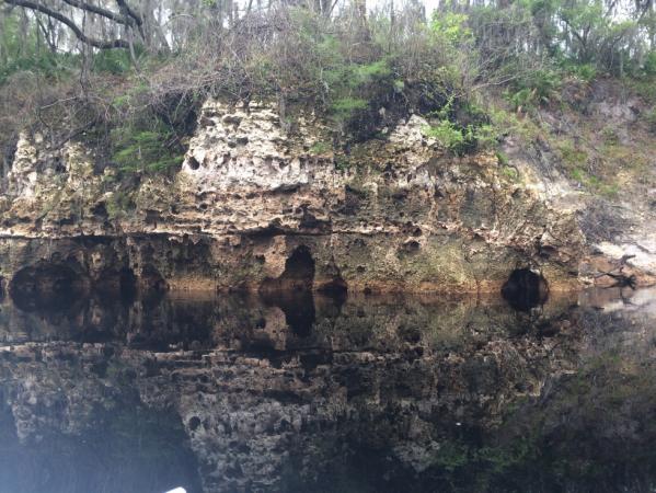
The next two days repeated a pattern of rising a couple hours before sunrise, pedaling in the rain past porous
limestone cliffs and river shacks with confederate flags, and then sheltering from evening thunderstorms.
Middle Suwannee Shoreline
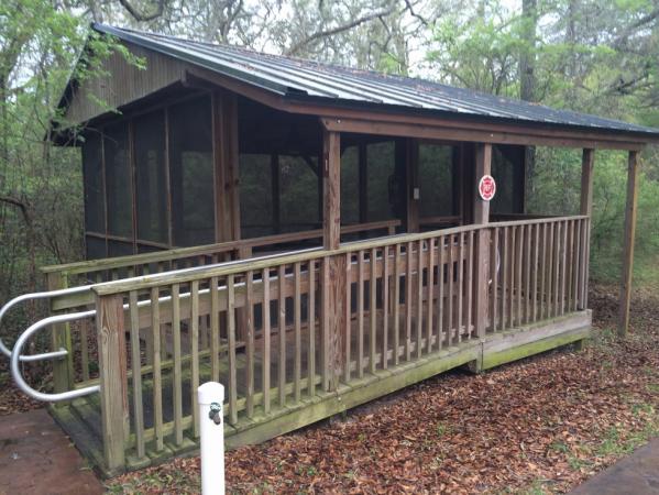
One side benefit was that I got lots of sleep and was able to stay at one of the free river camps. The camp at
Adams Tract had hot showers, individual camping “platforms” with electricity, water and even a cart to bring
your gear up from the boat. Everything was immaculately maintained. The down side was that I was slipping
further behind schedule.
Camping “platform” at Adams Tract
I put the long fins back on the drive unit (having gone two days without bending the short ones) and pushed off
at 0300 the next morning. A beneficial current and mostly light wind made for a 60 nm day before a stiff south
wind, driving rain and thunder drove us to take shelter in a mangrove. The trees blocked the wind well enough
that I was able to put up the Tyvek bimini tent, have a comfortable meal and generally get organized before bed,
despite the storm. A Barred owl, so close as to be startling, had a long animated conversation with his
compatriots.
Home sweet home
I awoke the next morning with anticipation, as this was to be the day to trade the meandering confines of the
Suwannee for open water. The appearance of stars and later patches of blue sky added to that sense of optimism.
The day pretty much unfolded as planned. A smooth Gulf of Mexico made for an easy pedal to Cedar Island, the
third UFC checkpoint. Chief, his wife Sandy, Paddledancer (Paula) and Leather Lungs (Neal Calore) were on the
beach in front of the Faraway Inn to greet me. Neal drove down from Philadelphia to surprise Jarhead, his
partner from an earlier UFC, who was a day or two behind me. He generously shared his hotel room and we all had
a nice dinner at a local restaurant (outstanding crab chowder). The evening was capped with a pleasant porch
conversation with Neal over a glass of chocolate milk.
Paula (race manager) patiently waiting for me to get the anchoring sorted out at Cedar Key
Just 69 nm of open Gulf and 40 nm of sheltered water to go! The forecast was near perfect with a northeast
breeze and only 10% chance of showers. I left around 0400 and carefully followed the channel around the many
sandbars, clam mounds and snags that populate the waters around Cedar Key. As dawn approached, small ripples in
the water announced the breeze, just as forecast. I put up the sail and had breakfast with a gorgeous red
sunrise. Hmmmm, red sky in morning… I checked the forecast with the one bar of phone reception remaining and it
was unchanged.
Red sky in morning…
On this section of the Gulf of Mexico a power plant canal breakwater extends seven miles out from the shore. I
really wanted to get around it and start cutting in toward shore, balancing the added route distance against the
risk of “hanging out there”. Bird Keys, about 25 nm away, fit the criterion as a suitable bailout. I had the
option at 19 nm to reassess and take a more direct route toward shore if need be. The northeast breeze and some
light pedaling kept the Queen moving over 4 knots to within about 7 nm of Bird Keys. The wind then died and the
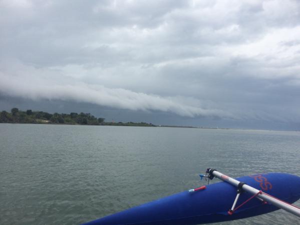
water went to glass. As the movie line goes: “it was quiet, too quiet”. A faint rumble of thunder could be heard
in the distance and the entire western sky was an ominous grey color with no visible horizon. I decided to risk
the charted shallows and take a more direct route to Bird Keys.
The shallow water was absolutely clear over a grass bottom. Sea turtles and small sharks scooted under the boat.
It would have been a great place to just drift and absorb the sights. Despite the relatively low tide, the drive
fins didn’t touch bottom until within a quarter mile of the keys.
The strange white lines seen miles off turned out to be flocks of Pelicans on the shore. The Bird Keys were
aptly named. Pelicans and Cormorants were everywhere. I found a small pond in the mangrove just before thunder
cracked overhead and hit the SPOT “ok” button to let folks know I had found shelter.
Through intermittent connectivity the cell phone displayed a solid line of lightning running north-south from
Tampa to the Suwannee River. Yeah right, 10% chance of showers. The rain held off long enough to cook up an
early supper and take it to bed with me (careful not to sit on it this time). After a meal and a bit of sleep,
the weather remained grey and blustery, but the thunder had stopped. Cell coverage was gone and the weather
radio didn’t tell me anything I couldn’t see with my own eyes, but sitting around all night was not particularly
appealing.
Around 1730 I slipped (actually had to walk the boat out) out of the lagoon and headed west for deep water,
before turning south. A stiff wind was coming out of the southwest, accompanied by the usual chop. Great, this
wasn’t in the forecast either. At least the wind would dry my clothes before the chill of night. The plan
(hope?) was to reach Anclote Keys before sunrise, but it didn’t look like that was going to happen. Conditions
were pretty grim for making rapid progress overnight.
After being on a small boat for three weeks, vulnerable to every nuance of wind, precipitation or temperature,
weather becomes “all about you”. After adding a headwind insult to the thunderstorm’s injury, Mother Nature
decided to make nice just before sunset. She gave me a double rainbow over the bow and soon afterward little
patches of pale blue sky appeared as wind started backing to the northeast.
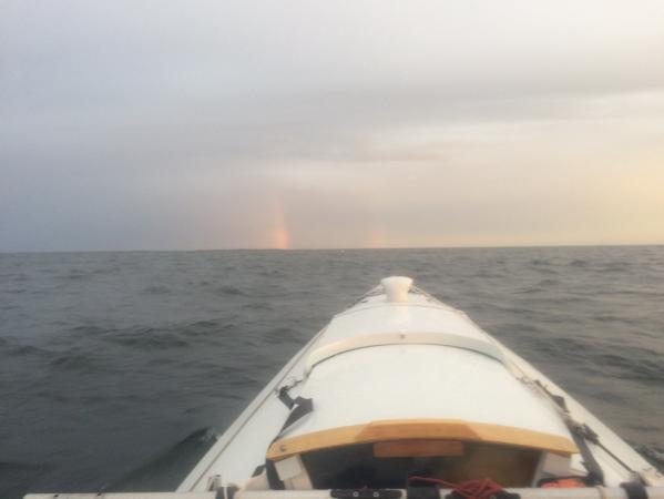
Makeup Rainbows (just for me I was sure)
In her playful manner, the wind rapidly rose to 15 knots+ and PQ was soon surfing over 8 knots under a reefed
sail. The Anclote Lighthouse and then lights of St. Petersburg became visible on the horizon as clouds thinned
to reveal a sky resplendent in bright stars. The wind would die and then restart from another direction multiple
times that night, before settling on an easterly direction. I anchored next to Anclote Key a couple hours before
sunup. The last open water crossing of the trip was complete.
The bright sun and chop from a stiff easterly breeze woke me up sometime before 0800 to start the last leg of
the trip. The first half of the day’s route was on a southwest heading, so the sailing was glorious. The wind
was amazingly stead and it stayed that way when the route changed to the southeast. Now it was work. I turned
off the GPS and resorted to “Zen mode”, concentrating on picking the path of least resistance through the chop
and trying to ignore the persistent nerve pain in my left foot (kept thinking of that stupid poster at the gym:
“pain is weakness leaving the body”…yeah, you go with that theory).
The finish at Fort DeSoto could be approached from the east or the west. The western approach was a little
shorter, but would be upwind for the last five miles or so. The eastern approach promised 2-3 miles under a
windward shore of the Sunshine Skyway and a five mile downwind finish. I chose the latter and was rewarded with
seven miles of pedal sailing and a downwind run to the finish. At 2046 Patuxent Queen touched the boat ramp at
Fort DeSoto. After 25 days, 13 hours and 46 minutes it was over.
Chief, Sandy, Paula, CoJones (pronounced as one word, accent on the second syllable) and Don were there. They
helped me unload the boat, made kind offers of lodging and then understandingly left me to pack up at my own
pace. The Pinellas County Sherriff wasn’t quite as understanding and visited multiple times during the night to
check on my progress. In fairness he was very polite, but it was clear he wanted me out of there. The boat was
securely on the trailer by 2230 and I started the drive home soon afterward.
Unloading at the Finish
I’m often asked the difficult question of how I felt at the finish. It was really just the end of another day on
the water, like the previous 24. Perhaps the only difference was the uncertainty over what to do next. It feels
a little empty when all of your efforts are focused on one goal and then that end is achieved. Fortunately that
is balanced by a renewed appreciation for friends, family and the really nice people you open up to along the
way. On the “me” side there is a satisfaction in having a plan that (mostly) comes together and having built a
boat that continues to perform better than expected.
Odds and Ends
Is the Mirage drive ready for prime time? With the introduction of needle bearings (“Glide Technology”) and hard
bolting the pedal arms, the system may finally be considered “reliable”. My unit went 1200 nm with a single cable tension adjustment.
All other maintenance was the result of me running into stuff. I carried sufficient parts to rebuild the entire
unit twice over, but never needed them. It was probably the most pleasant surprise of the trip.
How much did you sail? I didn’t keep an accurate log, but estimate that maybe a quarter of the trip was sailed
and the rest pedaled. The river sections were almost all pedaled for obvious reasons and headwinds dominated
much of the salt water portions of the trip, as evidenced by the low challenge completion rate. Having said
that, being able to sail Tampa and Biscayne Bays, as well as, much of the last Gulf of Mexico segment made the
Balogh worth having.
Copyright ©2016 Don Polakovics (Doooobrd)
|